VITAL SIGNS
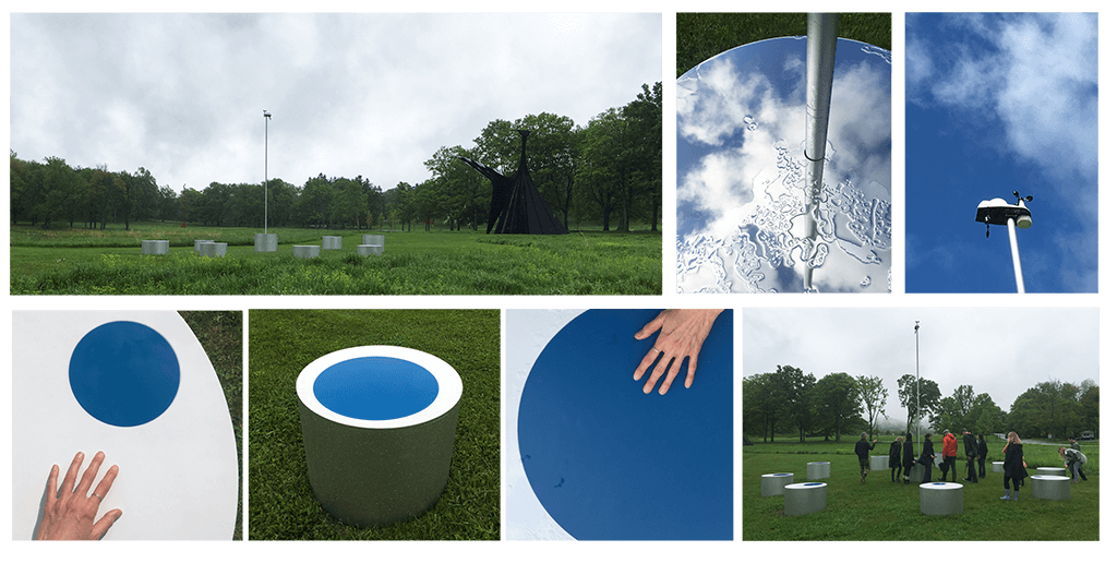
Vital Signs, 2018. Weather station, painted aluminum, mirrored aluminum, and wood. 20 x 30 x 30 ft. (609.6 x 914.4 x 914.4 cm)
I created a site specific work for Storm King Art Center’s 2018 show, Indicators: Artists on Climate Change. Vital Signs is an interactive weather station, whose ten elements refer to the disappearance of Arctic ice and the way scientists study its decline in a shifting climate. The cylindrical shape of each element recalls the storage tubes used to house ice core samples collected by paleoclimatologists to study climate history. As the dark blue area on each cylinder grows, the white surface diminishes by thirteen percent per cylinder, which corresponds to the predicted decrease in Arctic sea ice per decade relative to the 1981 to 2010 average. Likewise, each cylinder gets taller in reference to the predicted 33 millimeters of sea level rise per decade. These changes in color, height, and surface material from one cylinder to the next make visible the accelerated increase in dark oceanic water due to climate change, which results in further melting of arctic ice sheets—a phenomenon called the Arctic amplification effect. Vital Signs invites visitors to engage with the collection of data, and experience the temperature differentials between the dark and light areas as well as the volumetric change in ice melting by interacting with each element. Mirrored aluminum tops the middle cylinder, reflecting the faces of visitors and sky above. The instrument at the top of the pole gathers real-time climate data from weather measurement devices, which is accessible online at indicators.stormking.org.
Solomon Islands: Biological and Cultural Resilience
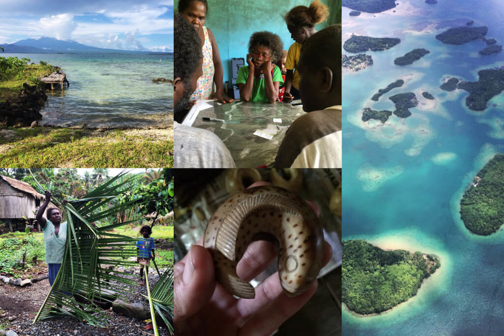
Coastal SEES Collaborative Research: Understanding Coupled Biological and Cultural Resilience across Coastal Pacific Island Systems. American Museum of Natural History, Center for Biodiversity and Conservation. Since 2015, I have been part of a team working on the interdisciplinary project “Biocultural Approaches to Sustaining Solomon Islands Customary Land and Sea,” working with western Solomon Island communities and other partners to understand relationships among changing pressures, biocultural states, and socio-ecological benefits in order to inform and advance reef-to-ridge community management and planning. Island social and ecological communities in the Western Pacific have a history of facing varying disturbances, and island peoples have responded creatively to these repeated but unpredictable changes. These island systems have unique cultural, agricultural, and biological diversity and could constitute models for how systems adapt to recurrent change. However, traditional strategies have faltered in areas in response to external forces. We are working within these systems to both advance theoretical understandings of biological and cultural resilience, and to contribute to local management. Within this context, we undertake interdisciplinary research to uncover relationships among changing pressures, biocultural states, and social-ecological benefits. And, within this interdisciplinary research, we use a range of techniques, including those based in visual arts, to both engage directly with community members in participatory modeling, mapping, and visioning exercises, and to interpret and represent the results of these exercises and our research.
Road Crossing Structures for Amphibians and Reptiles: Informing Design through Behavioral Analysis
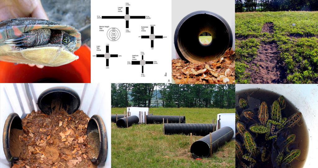
Every day, millions of vertebrates are killed on roads. Road traffic causes significant amphibian and reptile mortality, which could be mitigated through the installation of road crossing structures that facilitate safe passage, but only if reptiles and amphibians are willing to use them. Through a series of behavioral choice experiments with two species of frogs and two of turtles, I examined how aperture diameter, substrate type, length, and light permeability influenced individuals’ preferences for specific attributes of crossing structures, and how individuals responded to various heights of barrier fences. Tunnels > 0.5 m in diameter lined with soil or gravel and accompanied by 0.6 – 0.9 m high guide fencing would best facilitate road crossing for these and likely other frog and turtle species.
Waved Albatross: Mapping Nesting Density and Distribution
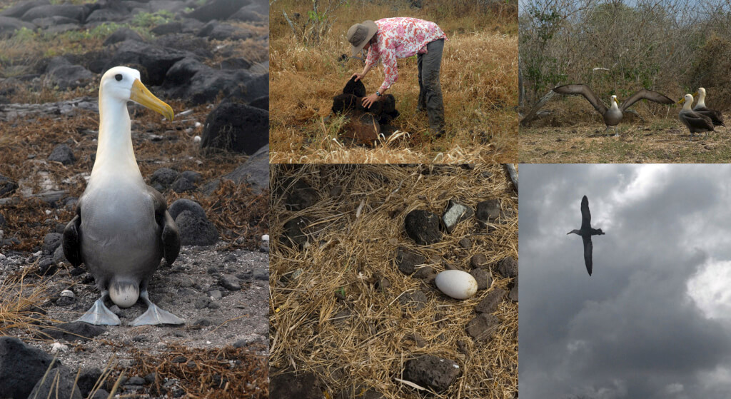 Española Island, Galápagos, Ecuador
The critically endangered Waved Albatross (Phoebastria irrorata) has declined due to human-induced threats. Long-line fishing is particularly damaging; individuals are often killed when they pick up and become ensnared on baited long-line fishing hooks, which stretch for miles through the seas. This albatross breeds only on the island of Española, yet little is known of the status of several nesting populations. In 2008 I was part of a team of scientists supported by the Charles Darwin Research Station and American Bird Conservancy to conduct a survey of nesting albatross and woody vegetation in the central and coastal colonies. We found evidence of a strong interaction between the distributions of vegetation and nesting albatross and designed a vegetation manipulation scheme that could better elucidate whether woody vegetation is limiting albatross nesting.
Española Tortoises: Tracing Distribution and Health
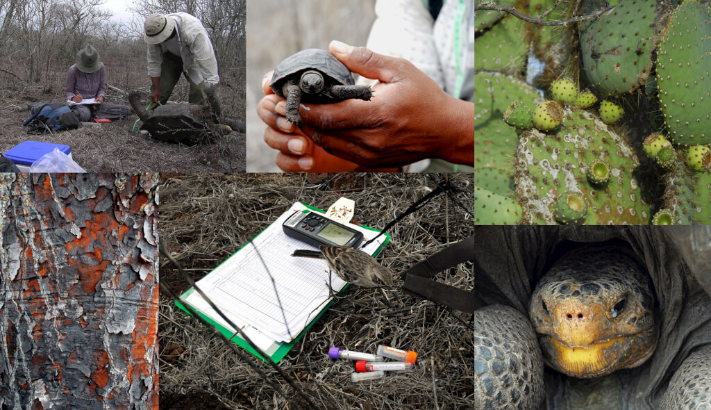 Española Island, Galápagos, Ecuador
The population of Giant tortoises (Geochelone nigra hoodensis) on Española Island once numbered approximately 3000, but centuries of exploitation and invasion reduced population sizes to approximately 13 individuals by the 1960s. At that point, all remaining tortoises were transferred to an off-site breeding center while goats, a significant threat to tortoise survival, were eradicated on the island. A reintroduction program has transferred offspring of the original tortoise population back to Española since 1971, and reproduction now occurs on the island as well. The population of tortoises has increased to approximately 1000 individuals, but information on the status of the tortoise population and the ecology of the island is critical to the continued success of restoration efforts. In 2007, I joined a team of scientists sponsored by the Charles Darwin Research Station and the Galápagos National Park to conduct a survey of tortoise population sizes, map tortoise distribution, and gather baseline health data. Future work will explore the trajectory and implications of this loss and restoration of the tortoise as “ecological engineer” on the island and its native species.
Galápagos Rail: Surveying a Population and a Landscape
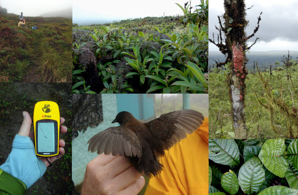 Santa Cruz Island, Galápagos, Ecuador
In this study, sponsored by the Charles Darwin Research Station, Galapagos National Park, and University of Delaware, I was part of a team that surveyed and documented the population and habitat of Galápagos rails, Laterallus spilonotus on Isla Santa Cruz. Currently, the population status of this elusive bird is unknown, and invasive species threaten the few existing populations. We re-surveyed an existing population on Santa Cruz Island and examined the influence of an invasion of the species’ habitat by the red-barked quinine tree (Cinchona pubescens). By comparing surveys from 2000 and 2007, we discerned that rail occupancy and abundance declined over time. Restoration of native vegetation could positively impact this population.
Orongo Station: Restoration and Conservation
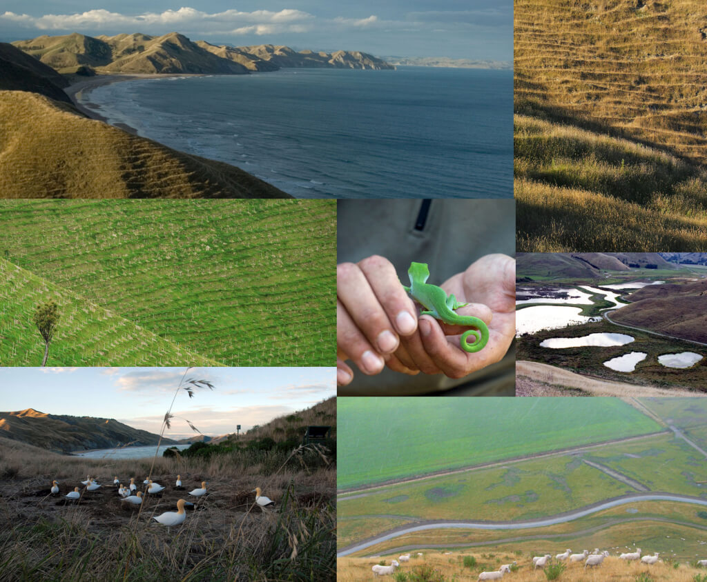
Orongo Station is a 680 hectare farm on the North Island of New Zealand. Over the past century, deforestation, intensive livestock farming, and wetland drainage profoundly damaged the land. I collaborated with Nelson Byrd Woltz landscape architects and Ecoworks New Zealand on the design and implementation of a conservation master plan for this culturally and ecologically significant site. Implementation combines a sustainable farming endeavor with large-scale ecological restoration and includes a 1.5 mile road design, 30 acre wetland reconstruction, a tuatara and gray petrel reserve, a reforestation program, and native plant arboretum.
